Riviera Makarska - Tourist guide
RIVIERA MAKARSKA - Croatia, Dalmatia: Choose the destination for holidays and make reservations on-line. Check our offer of cities, towns, coves and islands through thousands of our photos!


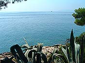
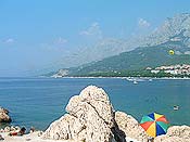
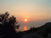
From the Vrulje creek in the northwest, to the Bacine village on the southeast stretches Makarska Riviera. It the inland boarders with the massive of Biokovo while on the sea it opens to the Brac cannal, Hvar island and Neretva river.
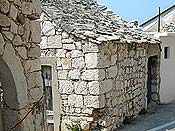
Riviera was ihabitated since the very remote periods. In the antique period we distinguish Maccarum (Makarska), Breulia ( Brela), and Biston (Bast e Baska Voda). According to the medieval text representing the classic map Makarska Riviera was crossed by a very important road connecting Salona and Narona, the important centre in the Neretva valley.
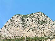
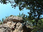
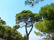
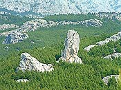
There incorporate high peaks and sloping rocks of Biokovo mountain and this interlacement between the mild luxuriancy of the mediterranean coast and strong expression of the monumental sloping rocks, made this region one of the most interesting parts on the croatian part of the Adriatic.
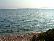
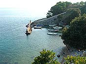
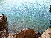
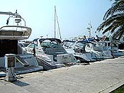
In a creek very conviniently closed by two peninsulas St. Peter e Osejava is situated the city of Makarska, almost in the centre of the Riviera surrounded by the Biokovo massive. And because of that Makarska developed into the strong regional centre.
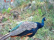
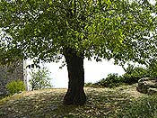
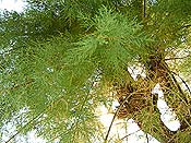
The singularity and diversity of the geomorfhological forms of the Biokovo mountain non to mention particular mediterranean plants with numerous endemic species, are the material for studies for past two centuries. That contributed to the allargement of the massive of Biokovo for 20.000 hectares and the proclamation of the Natural Park of Biokovo in the 1981 with the possibility to become the national park.
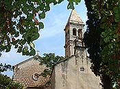
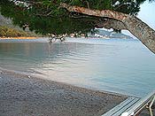
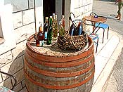
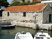
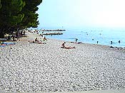
Riviera Makarska is one of the most important tourist regions on the croatian coast. The inhabitant places were formed after the descent towards the sea of the inhabitants who were occupated only by the feeding their cattle on the Biokovo plains. Thus Baska Voda developed under almost desolated mountain village Basta. In the same way Brela was formed on the ruins of the classic antique location of Berulije. Tucepi is situated to the southeast of Makarska, the location formed at the place of the roman villa. There is also Podgora along the sea where the road to Vrgorac begins. In the village of Igrane dominates the tall bell constructed following the example of the romanic bell of the cathedral in Split.
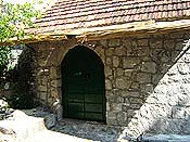
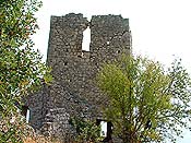
In the small village Markovici we can find the church of St. Michel (Sv. Mihovil) one of the most important monuments on the Makarska Riviere, constructed in the XI and XII century. In Zivogosce the Franciscans of Mostar constructed the convent in the 1620 and the church of the Saint Cross (Sv. Kriza). There was an agostinian convent in Zaostrog for a period of time, later abbandoned because of the fear of the Turks in the 1468.
In Gradac, a very antique place, happened one of the cruelist conflicts between the Turkish and Venetian military forces. The same village was destroyed to the ground in the Second World War when the Italian fascists put on fire the whole place.
The inland of the mountain massive toward the board to Bosnia and Herzegovina is named Imotska krajina, and it is the area inhabitated since the stone age. From the medieval fortress erected on a rock above the lake Modro jezero developed the village and the small town Imotski which become the centre of the region. Vrgorac was in the past the place of boardes and many conflicts,up to the recent period. It is also the native village of Tin Ujevic, one of the most interesting and valid croatian poets.